

Before the city was built at its present location, there were several villages in and around the area. To the south of the city were the villages of Deh Qal’eh and Qal’eh Now, while Deh Hesār was located to the west; these villages were demolished to make way for the construction of the city. At the present site of the city, there was a village called Dastgerdeh, traces of which remain in the form of a qanat known as the “Deh Qanat”.
The Origins of the City
During the Abbasid Caliphate, the region in which Arak is now located formed part of the territory of Jebal.
Until 1938 (1317 in the Iranian calendar), Arak was known as ‘Iraq, and before that as Soltanabad. The founder of the city was Yusuf Khan Gorji, also known as Sepahdar-e ‘Iraq. According to historical accounts, before the construction of the city, there were eight or ten fortresses in the area, known as Khan Babakhan, Hesār, Deh-Kohneh, Moradabad, Aqa Sami, Salim, Now and Qader. The inhabitants of these fortresses were frequently in conflict with one another. Yusuf Khan reported these conflicts to Fath-Ali Shah Qajar, who ordered him to demolish the fortresses and construct a new city.
At that time, two powerful tribal groups lived in the region: the Farahan Khans, who resided in what is now Farahan District, and the Kazzaz Khans, who lived in what is now Zalian District. After learning of the decision to establish a new city, a military settlement, both groups sought to persuade the central government to build the city in their respective territories, but neither succeeded. Yusuf Khan Gorji eventually decided to establish the city at its present location, at the westernmost point of the Farahan territory and the easternmost point of the Kazzaz territory, in order to prevent disputes and conflicts.
Having seen the cities of Georgia and the Caucasus, Yusuf Khan sought to build an orderly and well-planned city in which all streets would intersect at regular intervals. The width of all the streets was planned at six zara‘ (cubits). A bazaar was also established at the centre of the city so that it would be easily accessible to the entire population.
Urban Design and Construction
The planned city comprised a government citadel, containing all the administrative offices of the time, schools, numerous mosques, bathhouses, streets, residential houses, a bazaar, towers and defensive walls, as well as all necessary urban facilities.
To construct the city, a network of qanats was first excavated outside the city site, running from south to north. The qanat outlet was located in front of the southern gate of the city, known as the Qibla Gate. From there, the water supply was divided into three branches: one for the residents of the eastern part of the city, one for those in the west, and a third for the government citadel.
For defensive purposes, the city walls were built with towers and fortifications in the shape of a rectangle measuring 800 metres in length and 600 metres in width, surrounded by a moat 8 metres wide. Gates were installed on all four sides of the city walls. The rectangular layout was designed so that the city was oriented towards the qibla. This orientation allowed houses to benefit from sunlight during the winter while remaining cool in summer.
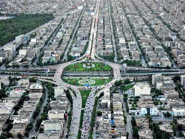
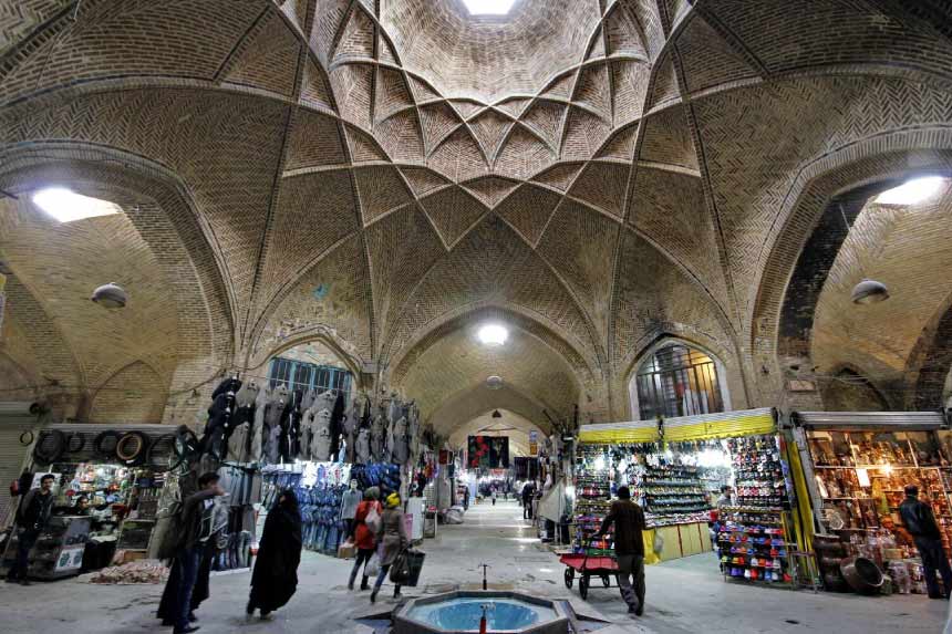
The city was divided into six equal sections in width and eight in length, creating a grid-like layout, with a five-metre-wide street running through each section. The central streets running along the length and width of the city were allocated to the bazaar, with four covered market sections constructed along them.
The administrative buildings of the government citadel were constructed in the northern part of the city. Public facilities, including bathhouses, water reservoirs, mosques, schools and saqqākhāneh (public water fountains), were established throughout the city. In the past, the city had extensive green spaces, with vineyards and vegetable gardens extending for several kilometres beyond the city walls.
Because the founder of the city spent much of his time on the battlefronts of the wars between Iran and the Ottoman Empire and Russia, the city was not constructed all at once; it took several years for its urban form to be completed. An inscription on the building of the Nazmiyeh administrative office records the date of its construction as 1227 AH, while an inscription in the corridor of the government citadel gives 1228 AH as the date of completion. Both buildings were demolished in 1929 (1308 in the Iranian calendar). Historical sources indicate that the construction of the city took place between 1227 and 1231 AH.
Urban Expansion
Following the completion of the city, Sepahdar Gorji encouraged the surrounding population to settle in the new city. He began with the villages of Kahrud, Senjan and Fijan, which were then collectively known as the “Three Villages”. A large number of khans and peasants from the surrounding areas were also settled in the two neighborhood of Qal’eh and Hesār.
One of the reasons for the irregular expansion of the city in subsequent years was the conversion of many of its gardens into residential properties. Since the boundaries of the gardens had been defined by irrigation channels with irregular routes, the houses built on these plots followed similarly irregular patterns. Another reason for the irregularity of the streets was the lack of municipal supervision over construction at the time.
In 1857 (1271 in the Iranian calendar), a wave of migrants began arriving in Arak from various places, including Golpayegan, Khomein, Borujerd, Kashan, Isfahan, Tabriz, Qom and Khansar, contributing to the beginning of the city’s economic prosperity. As a result, neighbourhoods such as Abbasabad, Manoqabad, Posht-e Khandagh and Hazavehi-ha were established. In 1929 (1308 in the Iranian calendar), with the cooperation of the ‘Iraq Municipality, the present-day Imam Khomeini Street, Abbasabad and the National Garden were developed, and the historic urban fabric was restored.
With the construction of the railway through the city, urbanization accelerated. During periods of peace and stability, the surrounding city walls were removed, and the city began to expand rapidly and without a coherent plan.
The Constitutional Revolution
When the Constitutional Decree was issued in 1906 (1285 in the Iranian calendar), 92 years had passed since the establishment of Soltanabad. On the eve of the Persian Constitutional Revolution, the Qajar government’s inability to support Iranian merchants in confronting foreign companies operating in Arak led merchants and industrial workers to join the struggle against foreign capital. This movement was led by Shi’a clerics with a long-standing presence in the region of ‘Iraq-e ‘Ajam, particularly in the village of Kahrud.
At the time, the religious schools and scholars of Arak were largely affiliated with reform-minded clerics in Najaf, including Akhund Molla Mohammad Kazem Khorasani. These figures led the Constitutional movement in Arak, the most prominent among them being Aqa Nour al-Din ‘Araqi. Following the issuance of the Constitutional Decree, Aqa Nour al-Din ‘Araqi established the first Provincial Association together with other reform-minded clerics.
Following the bombardment of the parliament and the period known as the Lesser Despotism, constitutionalists in Arak experienced less persecution than those in other parts of Iran owing to the considerable influence of Aqa Nour al-Din ‘Araqi.
Arak had six constitutionalist associations:
- Secret Association of Adamiyat, chaired by Aqa Asadollah Parvin;
- Democratic Association, led by Haj Mirza Abdolazim;
- Tadayyon Association, established at Sepahdar School and led by Sheikh Ali Aval;
- Association of Azerbaijanis, comprising Azerbaijanis of ‘Iraq-e ‘Ajam and led by Mirza Habibollah Akkas-Bashi;
- Brothers’ Association, led by Mirza Hassan Khan Harabadi and Mirza Ali-Akbar Kampani;
- Moderates’ Association, led by Majd al-Mamalek.
Following the issuance of the Constitutional Decree, Aqa Nour al-Din ‘Araqi established the first Provincial Association together with other reform-minded clerics. Following the bombardment of the parliament and the period of the Lesser Despotism, constitutionalists in Arak experienced less persecution than those in other parts of Iran owing to the considerable influence of Aqa Nour al-Din ‘Araqi.
The First and Second World Wars
Until 1857 (1271 in the Iranian calendar), the city primarily served a military function. In that year, according to Etemad al-Saltaneh, Mirza Hassan, the deputy governor of ‘Iraq, renovated the shops, government buildings and gardens of Soltanabad, planted trees and brought craftspeople and practitioners of various trades from other cities to settle in the city.
From this period onwards, the territory of ‘Iraq acquired an industrial and economic role in addition to its military function. Owing to its location along commercial routes, it attracted the attention of foreign companies. The arrival of foreign companies in Soltanabad led to the city’s rapid expansion and the establishment of new commercial, residential, administrative and recreational spaces. Thus, despite the economic stagnation prevailing in the country, the economy of Soltanabad flourished and conditions emerged for population growth in the region.
However, with the outbreak of the First World War in late 1914 (1293 in the Iranian calendar), the central government became unstable, and Russian and British forces entered and occupied the city. The occupation made the roads unsafe, causing the commercial economy of Soltanabad to collapse suddenly.
In September 1941 (Shahrivar 1320 in the Iranian calendar), the Second World War reached Iran. Reza Shah was removed from power, and parts of the country were occupied by the Allied forces. During this period, Arak was of particular strategic importance because it was home to one of the major stations of the Trans-Iranian Railway, and the city was consequently occupied by the Allied forces for several years.
The period from 1941 to 1953 (1320–1332 in the Iranian calendar) can be regarded as one of the notable periods of economic stagnation in Iran. The economic disorder of these years also affected Arak, and the city began to experience outward migration. During the Second World War, water and fuel were stockpiled in the city.
Following the occupation of Iran, famine, inflation and shortages of goods began. The Allied forces confiscated surplus grain from villagers, provoking a public reaction. In 1942 (1321 in the Iranian calendar), riots broke out in eight cities across the country. The events in Arak were particularly significant because the unrest was more extensive and persistent, continuing from September to March of that year.
On 24 August 1942 (2 Shahrivar 1321 in the Iranian calendar), the Minister of Finance requested that the Prime Minister dispatch troops to suppress the unrest, but the deployment of additional forces did not resolve the situation. In late November, market traders went on strike, and a number of people were arrested on the orders of Ahmad Qavam (Qavam al-Saltaneh). The strike ended following the intervention of the Minister of Food and threats and promises made to the strikers. The situation was repeated in March of the same year but ended quickly.
Before the city was built at its present location, there were several villages in and around the area. To the south of the city were the villages of Deh Qal’eh and Qal’eh Now, while Deh Hesār was located to the west; these villages were demolished to make way for the construction of the city. At the present site of the city, there was a village called Dastgerdeh, traces of which remain in the form of a qanat known as the “Deh Qanat”.
The Origins of the City
During the Abbasid Caliphate, the region in which Arak is now located formed part of the territory of Jebal.
Until 1938 (1317 in the Iranian calendar), Arak was known as ‘Iraq, and before that as Soltanabad. The founder of the city was Yusuf Khan Gorji, also known as Sepahdar-e ‘Iraq. According to historical accounts, before the construction of the city, there were eight or ten fortresses in the area, known as Khan Babakhan, Hesār, Deh-Kohneh, Moradabad, Aqa Sami, Salim, Now and Qader. The inhabitants of these fortresses were frequently in conflict with one another. Yusuf Khan reported these conflicts to Fath-Ali Shah Qajar, who ordered him to demolish the fortresses and construct a new city.
At that time, two powerful tribal groups lived in the region: the Farahan Khans, who resided in what is now Farahan District, and the Kazzaz Khans, who lived in what is now Zalian District. After learning of the decision to establish a new city—a military settlement—both groups sought to persuade the central government to build the city in their respective territories, but neither succeeded. Yusuf Khan Gorji eventually decided to establish the city at its present location, at the westernmost point of the Farahan territory and the easternmost point of the Kazzaz territory, in order to prevent disputes and conflicts.
Having seen the cities of Georgia and the Caucasus, Yusuf Khan sought to build an orderly and well-planned city in which all streets would intersect at regular intervals. The width of all the streets was planned at six zara‘ (cubits). A bazaar was also established at the centre of the city so that it would be easily accessible to the entire population.
Urban Design and Construction
The planned city comprised a government citadel, containing all the administrative offices of the time, schools, numerous mosques, bathhouses, streets, residential houses, a bazaar, towers and defensive walls, as well as all necessary urban facilities.
To construct the city, a network of qanats was first excavated outside the city site, running from south to north. The qanat outlet was located in front of the southern gate of the city, known as the Qibla Gate. From there, the water supply was divided into three branches: one for the residents of the eastern part of the city, one for those in the west, and a third for the government citadel.
For defensive purposes, the city walls were built with towers and fortifications in the shape of a rectangle measuring 800 metres in length and 600 metres in width, surrounded by a moat 8 metres wide. Gates were installed on all four sides of the city walls. The rectangular layout was designed so that the city was oriented towards the qibla. This orientation allowed houses to benefit from sunlight during the winter while remaining cool in summer.
The city was divided into six equal sections in width and eight in length, creating a grid-like layout, with a five-metre-wide street running through each section. The central streets running along the length and width of the city were allocated to the bazaar, with four covered market sections constructed along them.
The administrative buildings of the government citadel were constructed in the northern part of the city. Public facilities, including bathhouses, water reservoirs, mosques, schools and saqqākhāneh (public water fountains), were established throughout the city. In the past, the city had extensive green spaces, with vineyards and vegetable gardens extending for several kilometres beyond the city walls.
Because the founder of the city spent much of his time on the battlefronts of the wars between Iran and the Ottoman Empire and Russia, the city was not constructed all at once; it took several years for its urban form to be completed. An inscription on the building of the Nazmiyeh administrative office records the date of its construction as 1227 AH, while an inscription in the corridor of the government citadel gives 1228 AH as the date of completion. Both buildings were demolished in 1929 (1308 in the Iranian calendar). Historical sources indicate that the construction of the city took place between 1227 and 1231 AH.
Urban Expansion
Following the completion of the city, Sepahdar Gorji encouraged the surrounding population to settle in the new city. He began with the villages of Kahrud, Senjan and Fijan, which were then collectively known as the “Three Villages”. A large number of khans and peasants from the surrounding areas were also settled in the two neighbourhoods of Qal’eh and Hesār.
One of the reasons for the irregular expansion of the city in subsequent years was the conversion of many of its gardens into residential properties. Since the boundaries of the gardens had been defined by irrigation channels with irregular routes, the houses built on these plots followed similarly irregular patterns. Another reason for the irregularity of the streets was the lack of municipal supervision over construction at the time.
In 1857 (1271 in the Iranian calendar), a wave of migrants began arriving in Arak from various places, including Golpayegan, Khomein, Borujerd, Kashan, Isfahan, Tabriz, Qom and Khansar, contributing to the beginning of the city’s economic prosperity. As a result, neighbourhoods such as Abbasabad, Manoqabad, Posht-e Khandagh and Hazavehi-ha were established. In 1929 (1308 in the Iranian calendar), with the cooperation of the ‘Iraq Municipality, the present-day Imam Khomeini Street, Abbasabad and the National Garden were developed, and the historic urban fabric was restored.
With the construction of the railway through the city, urbanization accelerated. During periods of peace and stability, the surrounding city walls were removed, and the city began to expand rapidly and without a coherent plan.
The Constitutional Revolution
When the Constitutional Decree was issued in 1906 (1285 in the Iranian calendar), 92 years had passed since the establishment of Soltanabad. On the eve of the Persian Constitutional Revolution, the Qajar government’s inability to support Iranian merchants in confronting foreign companies operating in Arak led merchants and industrial workers to join the struggle against foreign capital. This movement was led by Shi’a clerics with a long-standing presence in the region of ‘Iraq-e ‘Ajam, particularly in the village of Kahrud.
At the time, the religious schools and scholars of Arak were largely affiliated with reform-minded clerics in Najaf, including Akhund Molla Mohammad Kazem Khorasani. These figures led the Constitutional movement in Arak, the most prominent among them being Aqa Nour al-Din ‘Araqi. Following the issuance of the Constitutional Decree, Aqa Nour al-Din ‘Araqi established the first Provincial Association together with other reform-minded clerics.
Following the bombardment of the parliament and the period known as the Lesser Despotism, constitutionalists in Arak experienced less persecution than those in other parts of Iran owing to the considerable influence of Aqa Nour al-Din ‘Araqi.
Arak had six constitutionalist associations:
- Secret Association of Adamiyat, chaired by Aqa Asadollah Parvin;
- Democratic Association, led by Haj Mirza Abdolazim;
- Tadayyon Association, established at Sepahdar School and led by Sheikh Ali Aval;
- Association of Azerbaijanis, comprising Azerbaijanis of ‘Iraq-e ‘Ajam and led by Mirza Habibollah Akkas-Bashi;
- Brothers’ Association, led by Mirza Hassan Khan Harabadi and Mirza Ali-Akbar Kampani;
- Moderates’ Association, led by Majd al-Mamalek.
Following the issuance of the Constitutional Decree, Aqa Nour al-Din ‘Araqi established the first Provincial Association together with other reform-minded clerics. Following the bombardment of the parliament and the period of the Lesser Despotism, constitutionalists in Arak experienced less persecution than those in other parts of Iran owing to the considerable influence of Aqa Nour al-Din ‘Araqi.
The First and Second World Wars
Until 1857 (1271 in the Iranian calendar), the city primarily served a military function. In that year, according to Etemad al-Saltaneh, Mirza Hassan, the deputy governor of ‘Iraq, renovated the shops, government buildings and gardens of Soltanabad, planted trees and brought craftspeople and practitioners of various trades from other cities to settle in the city.
From this period onwards, the territory of ‘Iraq acquired an industrial and economic role in addition to its military function. Owing to its location along commercial routes, it attracted the attention of foreign companies. The arrival of foreign companies in Soltanabad led to the city’s rapid expansion and the establishment of new commercial, residential, administrative and recreational spaces. Thus, despite the economic stagnation prevailing in the country, the economy of Soltanabad flourished and conditions emerged for population growth in the region.
However, with the outbreak of the First World War in late 1914 (1293 in the Iranian calendar), the central government became unstable, and Russian and British forces entered and occupied the city. The occupation made the roads unsafe, causing the commercial economy of Soltanabad to collapse suddenly.
In September 1941 (Shahrivar 1320 in the Iranian calendar), the Second World War reached Iran. Reza Shah was removed from power, and parts of the country were occupied by the Allied forces. During this period, Arak was of particular strategic importance because it was home to one of the major stations of the Trans-Iranian Railway, and the city was consequently occupied by the Allied forces for several years.
The period from 1941 to 1953 (1320–1332 in the Iranian calendar) can be regarded as one of the notable periods of economic stagnation in Iran. The economic disorder of these years also affected Arak, and the city began to experience outward migration. During the Second World War, water and fuel were stockpiled in the city.
Following the occupation of Iran, famine, inflation and shortages of goods began. The Allied forces confiscated surplus grain from villagers, provoking a public reaction. In 1942 (1321 in the Iranian calendar), riots broke out in eight cities across the country. The events in Arak were particularly significant because the unrest was more extensive and persistent, continuing from September to March of that year.
On 24 August 1942 (2 Shahrivar 1321 in the Iranian calendar), the Minister of Finance requested that the Prime Minister dispatch troops to suppress the unrest, but the deployment of additional forces did not resolve the situation. In late November, market traders went on strike, and a number of people were arrested on the orders of Ahmad Qavam (Qavam al-Saltaneh). The strike ended following the intervention of the Minister of Food and threats and promises made to the strikers. The situation was repeated in March of the same year but ended quickly.
Cuisine
Pomegranate
Pomegranate is one of the principal agricultural products of Markazi Province and the cities of Arak and Saveh. Saveh pomegranates are undoubtedly among the finest pomegranates produced in the country and are available in various varieties. The pomegranate harvest season extends from early autumn to late autumn, and a pomegranate festival is held annually in Saveh.
Walnuts
Walnuts are among the most important agricultural products of Arak and other cities in Markazi Province. Walnut orchards are abundant in many villages surrounding Arak, and the walnuts produced in the region are considered among the finest varieties in the country.
Nan-e Fātir
Nan-e Fātir is one of Iran’s traditional breads. Nan-e Fātir has traditionally been part of Arak’s Nowruz table and continues to be consumed today. Arak’s Nan-e Fātir is prepared without any yeast and is baked using traditional methods. In fact, Nan-e Fātir is a type of enriched sweet bread, topped with turmeric and baked in small pieces in a traditional oven.
Goosh-e Fil Pastry
Goosh-e Fil is a traditional pastry from Arak. Owing to its method of preparation and ingredients, it is particularly crisp, and it is a delightful afternoon treat when served with tea. The pastry is shaped like an elephant’s ear, which is the meaning of its name.
Grapes and Raisins
There are numerous vineyards around Arak, and more than 20 per cent of the country’s grape requirements are supplied by vineyards in the surrounding areas. The village of Hazaveh in Arak is one of the most important villages in terms of grape production. Grapes are used to produce and sell a variety of products, including grape molasses, grape syrup, grape vinegar, maviz (dried grapes), and serkeh-shireh.
Jozqand
Jozqand is a type of local confectionery from the city of Narāq that is also found in Arak and other cities of Markazi Province. Preparing Jozqand is a laborious process that takes approximately 15 days, making it one of the most expensive local confections. It is made from a fruit known as āleg. This fruit belongs to the same family as peaches and has a sweet and sour flavour.
The preparation of Jozqand is a collective activity traditionally carried out by women in Narāq. To make this confection, the fruit is peeled and left to dry in the sun on rooftops for three days. The stone is then removed, and the fruit is left in the sun for another day. It is subsequently filled with a mixture of almond kernels, sugar, cardamom, apricot kernels and icing sugar. This delicious confection has been inscribed on Iran’s National Intangible Cultural Heritage List.
Handicrafts
Carpets
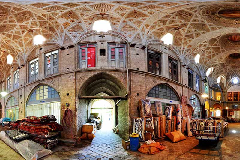
Sarough carpets are among the most popular souvenirs of Arak and are renowned internationally. Sarough is in fact a village located approximately 50 kilometres from Arak, famous for its world-renowned handwoven carpets. Arak’s carpets are traditionally divided into three categories: Mahal, Mushkabad and Sarough. All three fall under the broader category of carpets known as Sarough, demonstrating the importance and prominence of Sarough carpets.
One of the reasons for the international reputation of Sarough carpets is their distinctive weaving and knotting techniques, together with adherence to established standards in the weaving process.
Giveh
Sanjan Giveh is one of the traditional handicrafts of Arak. Sanjan is a village located on the slopes of Mount Qasbeh and is known for its numerous walnut orchards. Giveh is a traditional Iranian type of footwear that was historically worn during warm and mild seasons. Today, it is used only in some towns and villages.
Giveh has no distinction between left and right shoes and, because it is made from thread using a fabric-like weaving technique, it allows the feet to breathe and prevents excessive sweating.
Why and How Did Isfahan Become a UNESCO Creative City of Crafts and Folk Art?
Isfahan’s handicrafts are among the most authentic examples of artistic production in the global field of arts and crafts. The remarkable diversity of handicrafts and traditional arts, encompassing dozens of disciplines and hundreds of subcategories, has transformed the city into a unique centre and a well-established hub for artists and art enthusiasts. Art is present in every corner and neighbourhood of the city: from wood used in woodcarving and inlay work; mineral stones in turquoise inlay; precious stones and metals in goldsmithing and jewellery-making, silversmithing and copperware, engraving and filigree work; colours and canvas in miniature painting and illumination; plaster and stone in stucco work and sculptural structures; textile production and Qalamkar printing; carpet and local kilim weaving; silk weaving and embroidery; and leatherwork; to stone and bone, as well as wood and ivory, used in Khatamkari. Isfahan’s motifs and textiles, together with its leatherwork, textile printing and design, demonstrate that, in a word, every artistic discipline has its own distinctive tradition in Isfahan.
The presence of numerous local markets throughout Isfahan provides easy access to artistic products and handicrafts. This offers a special opportunity for tourists and has encouraged visitors from across Iran and around the world to travel to the city to admire and purchase its artistic works.
The historic city of Isfahan is located in central Iran and is the country’s third-largest city in terms of area and population. In terms of artistic production and the diversity of active and living artistic disciplines, Isfahan is renowned and distinguished not only in Iran but also internationally. UNESCO established the UNESCO Creative Cities Network (UCCN) several years ago to identify and promote cities with strengths in one of seven creative fields: Literature, Gastronomy, Crafts and Folk Art, Music, Media Arts, Design and Film. These fields reflect the spirit and character of creative activity in each city. It was through this framework that Isfahan joined the UNESCO Creative Cities Network.

Contact Information
Address
Unit 222, 2nd Floor, Phase 3, Jahan Nama Citadel, Taleghani St. Entrance, Opposite Shahr-e Ketab, Imam Hossein Sq., Isfahan, Iran
Phone Number
03132121470
Creative.city@isfahan.ir